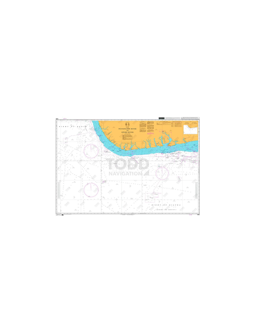


British Admiralty Nautical Chart 1386 Pennington River to Opobo River is corrected up to date.
Admiralty standard nautical charts comply with Safety of Life at Sea (SOLAS) regulations and are ideal for professional, commercial and recreational use. Charts within the series consist of a range of scales, useful for passage planning, ocean crossings, coastal navigation and entering port. Mariners should always use the largest scale nautical chart appropriate to their needs. In particularly busy seaways such as the English Channel, Gulf of Suez and the Malacca and Singapore Straits, the standard nautical charts are supplemented by mariners routing guides which provide advice on route planning in these complex areas.

(edit with the Customer Reassurance module)

(edit with the Customer Reassurance module)

(edit with the Customer Reassurance module)
Main Chart Details
Chart INT. 2809
Chart Title: Pennington River to Opobo River
Publication Date: 21/10/2004
Latest Edition date: 21/10/2004
Chart Size: 747 x 1098 (mm)
Panel Name Pennington River to Opobo River
Natural Scale: 350000
North Limit 5: 02'.00N
East Limit 7: 53'.00E
South Limit 2: 40'.00N
West Limit 4: 25'.00E

eTrex 20 takes one of the most popular and reliable GPS handhelds and makes it better. Redesigned ergonomics, an easier-to-use interface, paperless geocaching and expanded mapping capabilities add up to serious improvements for an already legendary GPS handheld.
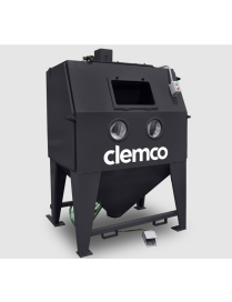
Clemco designs and builds engineered-to-order solutions for specialized parts handling?integrating automation, robotics, and enhanced interfaces to optimize your production process.?
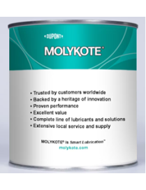
Heat-curing dry-film Lubricant
?
Product Sizes
1 kg can - 4 per carton
A heat-cured anti-friction coating filled with solid lubricants in an organic binder.
Whether you're working in the field or at a black-tie event, the SL300 is boldly designed to keep you efficiently connected. Measuring under an inch thick, the SL300 is ultra-portable with a stubby antenna, curved edges and rugged frame.? It features an Active View display with a matrix of LED lights behind the radio housing and ?Range Max? technology, an advanced radio design and patented antenna for enhanced range. Designed for easy and intuitive use and outfitted with the latest technology, the SL300 is the perfect work partner.?
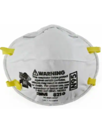
3M? 8000 Cup Series Particulate Respirators are lightweight, disposable respirators designed to provide convenient, reliable respiratory protection in situations where particulate respiratory protection is warranted and can provide protection from certain non-oil based particles.
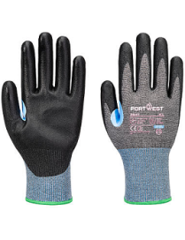
The CS Cut D15 PU Glove offers high-performance cut protection with the comfort and precision needed for demanding tasks. Featuring a Cut Level D rating, it guards against sharp hazards while allowing for excellent flexibility and control. The 15-gauge liner provides a breathable, lightweight fit, and the PU coating enhances grip and abrasion resistance for secure handling. A reinforced thumb crotch adds durability where it?s needed most, and touchscreen compatibility keeps you connected on the job. Ideal for automotive, construction, manufacturing, and precision work, this glove delivers the right mix of safety, comfort, and performance.
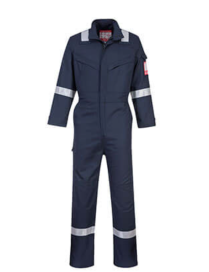
Independently certified to five international safety standards, the Bizflame Industry coverall is built for versatility. The special FR polyester in the fabric ensures maximum longevity in the toughest environments.
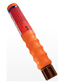
Particularly suitable for yachts, dinghies and sailboards, this water resistant, hand- held signal produces a dense orange smoke for daylight distress signalling and wind direction indication.
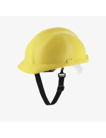
Versatile safety helmet with adjustable backstrap that you can rely upon in almost every industrial environment. The Kahna Standard offers a secure fit thanks to its 6-point harness and ergonomically designed shell. The helmet's ergonomic design also ensures perfect temperature control, even in warm environments. Comfortable and therefore suitable for continuous wear. This helmet comes with an extra chin strap.?
The Safety Jogger lightweight shoe with SJ-3FIT is the must-have for the hybrid workplace. With unique features such as a removable hybrid insole with a built-in air circulation system and shock absorption, you will have the lightest safety shoe on the market. Next to being ultra-comfortable, the light weight shoe has a topmost flexing & bending performance. Whereas toe cap is made of ultra-light nano carbon, the insole features our unique SJ-3FIT technology. The SJ-3FIT technology is a flexible, modular concept that allows the width of the shoe to be adjusted. All you need for happy feet at work!
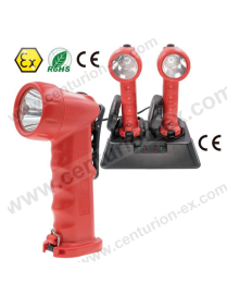
EX-2380 Intrinsically Safe Rescue Hand Lamp (Rechargeable) is ATEX Directive certified for safe use in hazardous locations in zones 1, 2, and zones 21, 22. It provides five output modes, high, medium, low, strobe light, and SOS, which apply to different situations. It's used a high-power LED for excellent light output, up to 120 lumens light output, at the high mode the duration up to 10 hours.
This high-strength hand lamp is exceptionally robust and reliable, proven shockproof, seal lens and end cap, scratch-resistant and chemically resistant glass lens, IP66 waterproof, and dustproof.
The compact, lightweight, and ergonomic hand lamp body give enhanced grip and easy for the user with one hand switch; even wearing gloves, you can also use a high-strength clip for hands-free use.
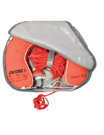
1 Horseshoe Lifebuoy ?Quick RD? (code 70164)
1 Lifebuoy Light (code 71325)
30 m floating rope, ? 8 mm, orange
1 horseshoe case made of durable PVC (code 72330)
Can be mounted on handrails
*Lifebuoy Light 70030 (not included) can also fit into the case
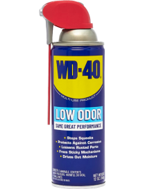
WD-40? Multi-Use Product lubricates moving parts such as hinges, wheels, rollers, chains, and gears. It protects against rust and corrosion on items like tools, bare steel, and outdoor equipment. It penetrates to free stuck corroded parts like nuts, bolts, valves, and locks. It displaces moisture to restore wet or flooded equipment such as engines, spark plugs, and power tools.
Like other pieces of essential safety equipment, the Philips HeartStart Home Defibrillator was designed to be safe, reliable and easy to use. Designed with you in mind, HeartStart Home is easy to set up and includes automatic features, like voice prompts and CPR guidance, to help guide you step-by-step through the treatment of sudden cardiac arrest. HeartStart Home was the first defibrillator approved by the Food & Drug Administration (FDA) for sale over the counter without a prescription.
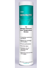
Grease for use under a wide range of temperature conditions for light-load applications where there is metal-to-metal or metal-to-plastic friction at low to high speeds
?
Product Sizes
400 g cartridge - 10 per carton
3.6 kg pail - 4 per carton
18 kg pail
180 kg drum
100g-10CTN, tub
?
KEY PROPERTIES
NLGI Grade 2 - Silicone-based grease with a base oil viscosity of 76 cSt at 40?C, lithium-thickened, with no solid lubricants.
British Admiralty Nautical Chart 1386 Pennington River to Opobo River is corrected up to date.
Admiralty standard nautical charts comply with Safety of Life at Sea (SOLAS) regulations and are ideal for professional, commercial and recreational use. Charts within the series consist of a range of scales, useful for passage planning, ocean crossings, coastal navigation and entering port. Mariners should always use the largest scale nautical chart appropriate to their needs. In particularly busy seaways such as the English Channel, Gulf of Suez and the Malacca and Singapore Straits, the standard nautical charts are supplemented by mariners routing guides which provide advice on route planning in these complex areas.