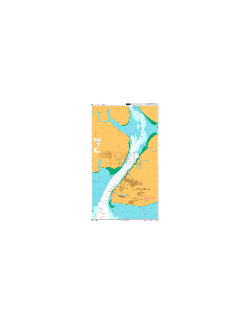


British Admiralty Nautical Chart 3287 Bonny River - Field Point to Ford Point is corrected up to date.?
Admiralty standard nautical charts comply with Safety of Life at Sea (SOLAS) regulations and are ideal for professional, commercial and recreational use. Charts within the series consist of a range of scales, useful for passage planning, ocean crossings, coastal navigation and entering port. Mariners should always use the largest scale nautical chart appropriate to their needs. In particularly busy seaways such as the English Channel, Gulf of Suez and the Malacca and Singapore Straits, the standard nautical charts are supplemented by mariners routeing guides which provide advice on route planning in these complex areas.

(edit with the Customer Reassurance module)

(edit with the Customer Reassurance module)

(edit with the Customer Reassurance module)
Chart INT. 2897
Main Chart Details
Chart Title: Bonny River - Field Point to Ford Point
Publication Date: 09/11/1990
Latest Edition date: 17/11/2016
Chart Size: 644 x 1106 (mm)?
Chart Panel Details
Panel Name: Bonny River - Field Point to Ford Point
Area Name: Nigeria
Natural Scale: 25000
North Limit 4: 36'.00N
East Limit 7: 14'.20E
South Limit 4: 21'.00N
West Limit 7: 05'.50E
Co-ordinates given are usually those of the four extremities of the chart. In many cases not all the area within will be fully charted*.Customers should check that the chart meets their requirements by viewing the chart image (where available).Mariners should always use the largest scale navigational chart available.
*Reasons may include

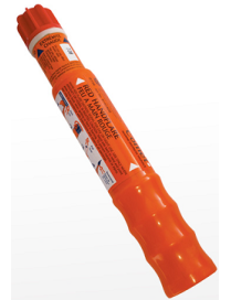
Unique, compact, telescopic handle allows easy extension for safe operation and saves space when stowed in liferafts.
The Handflare MK8 conforms to SOLAS 74 as amended. Designed to withstand exceptional environmental exposure and to perform reliably even after immersion in water. Featuring a telescopic handle with improved grip, making it very compact for stowage. Easily extended for safe handling and operation by pull wire ignitor. Produces hot red flame for 60 seconds at 15000 candela.
Vaultex V251 Safety Spectacles are protective eyewear designed to provide safety and protection in various work environments. The clear lenses are ideal for general use in well-lit environments or when maximum visibility is required. They provide excellent clarity and allow the wearer to see colors and details without distortion while protecting the eyes from potential hazards such as flying particles, dust, and splashes. Dark lenses are specifically designed for environments with bright light conditions or where protection from intense light or glare is necessary. Dark lenses help reduce eye strain and provide protection against harmful UV rays.
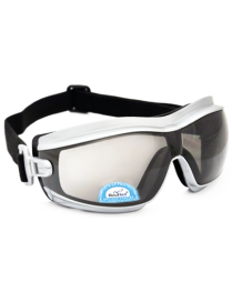
3M? SecureFit? 3700 Series is designed to offer eye protection with all-day wearability for workers with prescription eyeglasses. Adjustable ratchet temples allow the user to adjust lens for facial features and eyeglass position. Since prescription eyeglasses may not be anti-fog coated, workers can choose between a standard anti-scratch coating or 3M(TM) Scotchgard(TM) Protector Anti-Fog Coating.
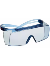
For safety spectacles that fit over prescription glasses and feature adjustable ratchet temples, use 3M? SecureFit? Overspectacles 3700 Series. Our lightweight overspectacles are designed to fit over the users existing glasses to provide personalised protection. The adjustable ratchet temples provide angle adjustment points on the temple to help ensure a secure fit.?
Maximum grip with maximum impact protection. Abrasion resistant nitrile foam coating. Exceptional grip for water, grease and oil. Lightweight and breathable seamless liner. Hook & Loop strap for secure fit all day long.
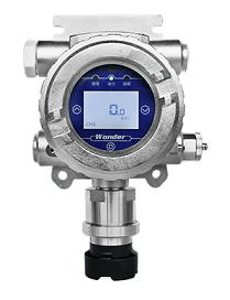
GTQ-WD6200 fixed gas detector is designed for industrial use. By adopting high-performance gas sensor and MCU technology, combined with sophisticated SMT manufacturing process, this detector has good repeatability, high accuracy and long lifespan.
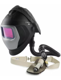
The 3M? Speedglas? 9100-Air Welding Helmet with Fresh-Air III Cooling Valve provides an assigned protection factor (APF) of 25, and the ability to decrease air temperature by up to 50?F (28?C). Designed for use with 3M? auto-darkening filters, the durable headcover helps keep the face and eyes safe from flying debris, sparks, and the effects of intense light from MIG, TIG, and stick welding.
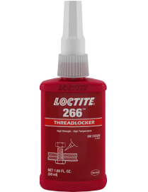
When a high strength, high-temperature resistant threadlocker is required, consider LOCTITE? 266. It is high strength and cures rapidly on fasteners lightly coated with rust prevention oils, and locks fasteners up to 19 mm (3/4") in diameter. Once cured, it prevents fastener loosening caused by severe shock and vibration, and resists temperatures up to 232?C (450?F). Ideal for heavy duty applications, e.g. bolts used in transmissions, construction equipment or railroad assemblies.
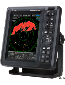
The simplified ARPA function helps to prevent a collision risk with other vessels or objects. Up to five targets can be automatically tracked on the radar echo, when a target enters within the set watch area, (or up to ten targets can be tracked when manually set). By selecting one of the targets, the target information such as position, course, speed, CPA, TCPA, bearing, and distance is shown on the lower side of the display. When the target enters within the CPA and TCPA limits, an alarm message is displayed with a beep alarm.
The CAT III 1500 V/CAT IV 1000 V True-RMS Fluke 283 FC Digital Multimeter and a283 FC True-RMS Wireless Current Clamp set the new standard for technicians in DC environments up to 1500 V. Whether you?re working with a utility-scale solar photovoltaic (PV) array, wind power, an electric railway, or a data center, the Fluke 283 FC has been engineered to enhance safety and increase productivity while giving you accurate, reliable, and repeatable results.
The 283 FC/PV includes CAT III 1500 V DC safety-rated accessories so you can work confidently in higher voltage environments without compromising safety. Staubli MC4 test leads allow you to quickly make reliable, secure connections to modules or strings to test DC voltage up to 1500 V DC.??
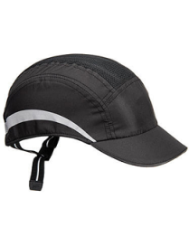
Experience unbeatable comfort and protection with our innovative bump cap. Its super lightweight design and unique inner shell provide superior breathability and comfort, while the EPP foam ensures optimal impact protection. With an additional comfort liner for a soft feel, this bump cap is the perfect choice for all-day wear. Available in four popular colourways, it's the ultimate combination of style and safety.
Unitor DieselPower Biocontrol is the solution when fuel contamination is found in marine diesel fuel. The product is effective against a variety of microorganisms contaminating fuel tanks and systems. If you find contamination in fuel tanks Unitor DieselPower Biocontrol is an effective biocide to remove any contamination.
Product number: 779082
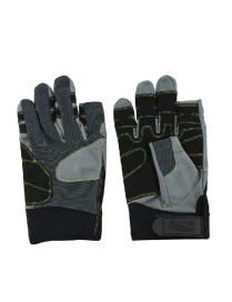
Durable Amara leather gloves with the index and middle fingers cut for improved dexterity and tactile control. Ideal for tasks requiring both hand protection and precision, such as marine work, handling equipment, or safety operations.
Now made with 100% recycled and recyclable plastic this updated station is manufactured in high visibility green from recycled plastic materials incorporating two 500ml bottles of sterile solution, two eye pads, and an extra-large shatterproof mirror. With isolated workers in mind, easy to follow instructions on the fascia make self-administration by an injured person practical and straightforward.
The innovative wall mounting layout is almost half the size of traditional eye wash stations, and now makes it possible to deliver a complete response for emergency eye injuries in virtually any location.
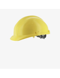
The Kanha Light is a comfortable helmet that offers all-day protection against impact and splashes. Thanks to its low weight, it ensures remarkable comfort throughout the day. This also makes it the perfect visitor helmet for those who are not used to wearing head protection. With the wheel ratchet at the back, you can easily adjust the fit of the helmet to your preferences. Suitable for a wide range of applications, such as the construction, chemical, automotive and logistics industry.
?
Long range,day and night distress signalling rocket. Designed to withstand exceptional environmental exposure and to perform reliably even after immersion in water. Features improved grip for easy handling and conforms to SOLAS 74/88 as amended. Rocket propels a red flare attached to a parachute to 300m and burns for 40 seconds. SOLAS requires that 12 rockets are carried on Ships Bridge and 4 rockets are fitted in liferafts and lifeboats. Also used by leisure craft.
The Comet Red Parachute Signal Rocket conforms to SOLAS 74 as amended. Designed to withstand exceptional environmental exposure and to perform reliably even after immersion in water, the pull wire ignitor and improved grip provides easy handling.?
British Admiralty Nautical Chart 3287 Bonny River - Field Point to Ford Point is corrected up to date.?
Admiralty standard nautical charts comply with Safety of Life at Sea (SOLAS) regulations and are ideal for professional, commercial and recreational use. Charts within the series consist of a range of scales, useful for passage planning, ocean crossings, coastal navigation and entering port. Mariners should always use the largest scale nautical chart appropriate to their needs. In particularly busy seaways such as the English Channel, Gulf of Suez and the Malacca and Singapore Straits, the standard nautical charts are supplemented by mariners routeing guides which provide advice on route planning in these complex areas.