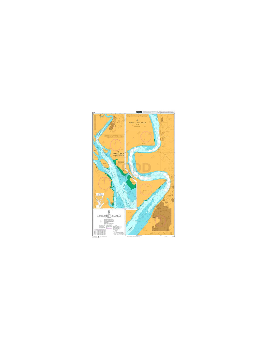


ADMIRALTY Chart - 3434 Approaches to Calabar, Sheet 2 is corrected up to date.
Admiralty standard nautical charts comply with Safety of Life at Sea (SOLAS) regulations and are ideal for professional, commercial and recreational use. Charts within the series consist of a range of scales, useful for passage planning, ocean crossings, coastal navigation and entering port. Mariners should always use the largest scale nautical chart appropriate to their needs. In particularly busy seaways such as the English Channel, Gulf of Suez and the Malacca and Singapore Straits, the standard nautical charts are supplemented by mariners routeing guides which provide advice on route planning in these complex areas.

(edit with the Customer Reassurance module)

(edit with the Customer Reassurance module)

(edit with the Customer Reassurance module)
Main Chart Details
Chart Title: Approaches to Calabar Sheet 2?
Publication Date: 12/07/1991
Latest Edition date: 24/08/2006
Chart Size: 668 x 980 (mm)
Chart Panel Details
Panel Name: A Jamestown to Calabar
Natural Scale: 50000
North Limit 4: 59'.50N
East Limit 8: 24'.50E
South Limit 4: 38'.80N
West Limit 8: 15'.00E
Panel Name B: Ports of Calabar
Natural Scale: 10000
North Limit 5: 01'.70N
East Limit 8: 19'.60E
South Limit 4: 56'.38N
West Limit 8: 17'.45E

Product Sizes
?
?
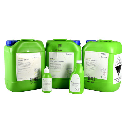
Solution for cleaning of the accommodation area on the vessel. The package contains all the basic cleaning products needed to maintain a clean and hygienic living quarters for the crew on board.
Product number: 770032
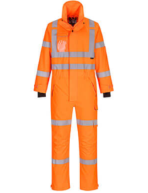
This highly technical waterproof rainsuit made from 300 denier stretch fabric is guaranteed to keep you visible from head-to-toe. With 11 innovative pocket solutions, a fantastic fit and ergonomic design, this mesh lined shell suit will make sure you can get the job done while staying fully protected all year round.
JL269 is an industrial type portable gas leakage detector with simple operation, fast response and wide measuring range. With flexible goose-neck, it is easy to use and carry. It is specially made to measure the leakage of natural gas, LPG, H2 etc. combustible gases.
Designed for professional use, the 3M? Multi-Purpose Quick Latch Reusable Respirator 65023QL provides convenience and respiratory protection on the job. Equipped with our Quick Latch system, this reusable half face respirator is easy to take on and off when in non-contaminated areas without removing the head straps. The NIOSH-Approved OV/AG/P100 combination cartridges help reduce expose to certain organic vapors and acid gases and provide at least 99.97% filtration efficiency against solids and liquid aerosols, as well as oil-based particulates. The 3M? Cool Flow? Valve helps release exhaled breath from inside the respirator for easy breathing, while the 3M? Bayonet Connection makes it compatible with a wide range of 3M cartridges and filters.
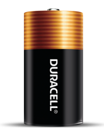
Get dependable, long lasting Coppertop batteries. These batteries have been engineered to deliver the life you need for your suitable, everyday devices.
A waistcoat style, the Offshore 290N has open sides and a versatile adjustment system allowing it to fit most adults. It has one automatic inflation chamber and a second manually operated chamber. The first chamber activates automatically on water entry to enhance your mobility when swimming, moving around and performing rescues. The second chamber can then be activated manually if required to give the full 290N buoyancy. This makes the lifejacket ideal for use in extremely rough conditions, or when supporting a survivor in the water. Each chamber is fitted with a 60g CO2 cylinder.
Complete with all the safety features you would expect from a professional lifejacket, the Offshore 290N includes twin flare pockets, integrated safety line, spray hood and thigh straps.
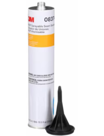
3M? MSP Sprayable Seam Sealer is a gray high-performance, general-purpose seam sealer that can be caulked or sprayed. This convenient, easy-to-apply sealer adheres well to all primed surfaces, except acrylic lacquer. It offers the convenience of allowing for painting almost immediately after being applied.
Simple to use
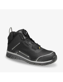
Light like space, strong like a rock. The LIGERO2 S1P is one of the lightest safety shoes on the market, fit for light applications. This lightweight shoe offers metal-free protection, with an ultralight nanocarbon toe cap and a non-woven puncture-resistant midsole that protect against toe crushing and perforation. It also features a slip-resistant outsole, breathable upper and removable foam footbed with extra shock absorption. The LIGERO2 S1P TLS has a TLS closure, offers a wide fitting and is made of robust materials that withstand wear and tear.
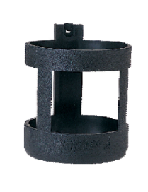
High-quality black polycarbonate lifebuoy light holder. Designed to hold the light vertically in the ?off? position and to provide easy removal in emergencies.
*Impa Code 331380
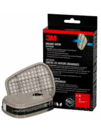
The 3M? Organic Vapor Cartridge 6001 provides a quick and easy replacement solution when working with organic vapors encountered when working with latex and oil-based paints, including spray paints, sealants, solvents and more.? This NIOSH-Approved Organic Vapor respirator cartridge helps provide respiratory protection against certain organic vapors. It?s designed for use with 3M? 6000, 6500 and 7500 series facepieces, attaching using the 3M? Bayonet Connection. For airborne particulates, combine it with a 3M? Particulate Filter 5P71, P95, and a 3M? Filter Retainer 501. This pack contains 1-pair of 3M? Organic Vapor Cartridges 6001.?
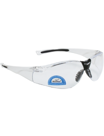
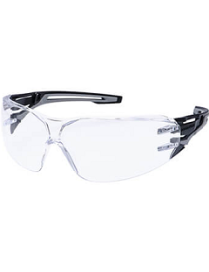
The Anthracite Wraparound Safety Glasses offer superior protection with a sleek, full-wrap design that shields eyes from debris and hazards. Their durable, lightweight frame ensures comfort and clarity during extended wear.
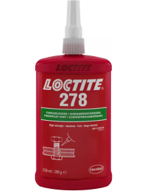
LOCTITE? 278 is a green, high strength, medium-viscosity threadlocker with a fixture time on steel and brass of 20 minutes, and on stainless steel of 60 minutes. Withstands high temperatures up to 200?C (392?F), and has proven capable of providing breakaway torque on M10 bolts of 42 Nm.
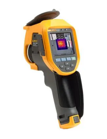
Every day you work hard to get the job done. Fluke gets that. For over 70 years, we have worked with people in the industrial trades. We understand that you need thermal imagers that will get the job done; rugged general use, every day thermal imagers that are easy to use, accurate and create high quality images. The Fluke Ti401 PRO is exactly this type of camera. It is an ideal camera for certified or uncertified thermographers working in:
ADMIRALTY Chart - 3434 Approaches to Calabar, Sheet 2 is corrected up to date.
Admiralty standard nautical charts comply with Safety of Life at Sea (SOLAS) regulations and are ideal for professional, commercial and recreational use. Charts within the series consist of a range of scales, useful for passage planning, ocean crossings, coastal navigation and entering port. Mariners should always use the largest scale nautical chart appropriate to their needs. In particularly busy seaways such as the English Channel, Gulf of Suez and the Malacca and Singapore Straits, the standard nautical charts are supplemented by mariners routeing guides which provide advice on route planning in these complex areas.