Home

Subcategories

  • Personal Safety

    Personal safety is the practice of protecting yourself from situations that could cause harm or danger. It involves being aware of your surroundings, recognizing potential risks, and taking steps to prevent accidents or threats. Personal safety covers many areas, including home security, online safety, travel awareness, and self-defense.

  • Marine Safety and...

    Marine safety is the discipline concerned with safeguarding life, property, and the marine environment from the dangers associated with maritime activities. It involves the implementation of international and national laws, safety standards, and operational procedures aimed at preventing accidents such as collisions, fires, and shipwrecks. Key aspects include vessel design and maintenance, crew training, navigation safety, emergency preparedness, and pollution prevention.

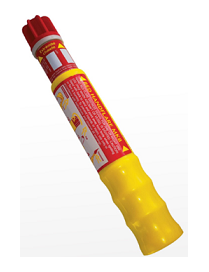
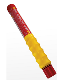
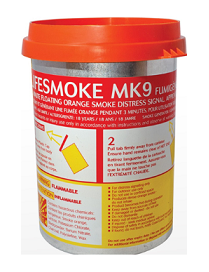
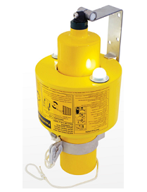
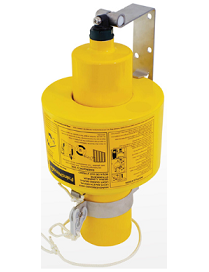
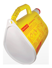
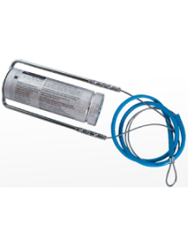
    Organizations such as the International Maritime Organization (IMO) set global standards for ship safety, pollution control, and seafarer training through conventions like the SOLAS (Safety of Life at Sea) and MARPOL (Marine Pollution) treaties. Marine safety also covers the use of safety equipment (e.g., life jackets, lifeboats, distress signals), adherence to navigation rules, and the management of hazardous materials onboard ships.

    Ultimately, marine safety ensures that maritime operations are conducted responsibly and efficiently, protecting human lives, marine ecosystems, and the economic interests tied to global shipping and ocean use.

  • Industrial safety

    Choosing the right industrial supplier can make all the difference in performance, safety, and efficiency. Ceesea Safety limited is committed to helping businesses across industries minimize downtime and maximize productivity. Explore our catalog or contact our team today to get a custom quote for your industrial supply needs

  • Instrumentation and...

    Instrumentation and Digital Devices is a field dedicated to the design, development, and application of advanced instruments and systems that measure, control, and automate industrial and scientific processes. Our focus is on integrating precision hardware with intelligent digital technologies to enhance efficiency, accuracy, and performance across diverse sectors.

  • Medical Safety

    At Ceesea Safety Ltd, we provide top-quality medical supplies and equipment trusted by healthcare professionals, clinics, and individuals. From diagnostic tools and wound care products to mobility aids and personal protective equipment, our wide selection ensures safety, reliability, and comfort. We?re committed to excellence, fast delivery, and exceptional customer service?because your health deserves the best.

  • Tools and Machinery

    Welcome to Ceesea Safety Limited, your trusted source for high-quality tools and industrial machinery. We specialize in providing durable, reliable, and performance-driven equipment for construction, manufacturing, automotive, and workshop needs. Whether you?re a professional tradesperson or a DIY enthusiast, our wide range of tools ensures precision, power, and productivity for every job.

Active filters

  • Brand: ADMIRALTY
  • Brand: PainsWessex

PainsWessex Red Handflare Mk8

Red hand-held, short range distress signal. Used to pinpoint location by day or night. Burns for 60 seconds at 15,000 candela. Features a unique telescopic handle making it very compact and space saving when stowed in a liferaft. Easily extended and pull wire operated.

PainsWessex Para Red Rocket Mk8A

The Pains Wessex Para Red MK8A Rocket conforms to SOLAS 74/88 as amended. Designed to withstand exceptional environmental exposure and to perform reliably even after immersion in water, the pull wire ignitor and improved grip provides easy handling. Ejecting a red flare on a parachute at 300m (1000ft), burning for 40 seconds at 30,000 candela

PainsWessex Lifesmoke Mk9

The NEW Pains Wessex Lifesmoke MK9 is a compact, flat top, day time distress signal designed to be easy and safe to handle. It provides effective position marking during rescue operations and can be used to indicate wind direction, producing dense orange smoke for a minimum of 3 minutes.

PainsWessex Manoverboard Mk9

The Pains Wessex Manoverboard MK9 Compact Lifebuoy Marker is normally mounted on a ship's bridge wing attached to a 4 kg lifebuoy. It is automatically or manually deployed to mark the position of a person in the water by day or night. Featuring a self-activated LED lighting system which exceeds SOLAS requirements for 2 candela light output and 2 hours duration, plus providing 15 minutes of dense orange smoke. Ships are required to fit at least two markers.

PainsWessex Buoysmoke Mk9

15 minute orange smoke Man Overboard day time Lifebuoy marker. Identical to Manoverboard MK9 Light & Smoke Signal - but without the lighting system. This version is required for USA and Japanese flag vessels.

PainsWessex Linethrower 250

A self-contained line-throwing appliance consisting of a plastic case with an end cap and 250m of line, an integral striker mechanism plus a rocket.

To comply with SOLAS requirements, four complete rocket and line assemblies (Item No. 9502000) should be carried on board. The device has a throwing range of between 230m and 250m. A solid propellant is used which guarantees a highly accurate flight path even in strong sidewinds.

British Admiralty Nautical Chart 1321 Ports and Terminals in the Gulf of Guinea

British Admiralty Nautical Chart 1321 Ports and Terminals in the Gulf of Guinea. This nautical chart complies with Safety of Life at Sea (SOLAS) regulations and is ideal for professional, commercial and recreational use. Charts within the series consist of a range of scales, useful for passage planning, ocean crossings, coastal navigation and entering port.


Mariners should always use the largest scale nautical chart appropriate to their needs. In particularly busy seaways such as the English Channel, Gulf of Suez and the Malacca and Singapore Straits, the standard nautical charts are supplemented by mariners routing guides which provide advice on route planning in these complex areas

ADMIRALTY Chart - 3288 Bonny River, Ford Point to Port Harcourt

British Admiralty Nautical Chart 3288: Nigeria, Bonny River, Ford Point to Port Harcourt is a standard nautical chart. This nautical chart complies with Safety of Life at Sea (SOLAS) regulations and is ideal for professional, commercial and recreational use. Charts within the series consist of a range of scales, useful for passage planning, ocean crossings, coastal navigation and entering port.


Mariners should always use the largest scale nautical chart appropriate to their needs. In particularly busy seaways such as the English Channel, Gulf of Suez and the Malacca and Singapore Straits, the standard nautical charts are supplemented by mariners routeing guides which provide advice on route planning in these complex areas.

British Admiralty Nautical Chart 1387 Calabar to Bata including Isla de Bioko

British Admiralty Nautical Chart 1387 Calabar to Bata including Isla de Bioko is corrected up to date.


Admiralty standard nautical charts comply with Safety of Life at Sea (SOLAS) regulations and are ideal for professional, commercial and recreational use. Charts within the series consist of a range of scales, useful for passage planning, ocean crossings, coastal navigation and entering port. Mariners should always use the largest scale nautical chart appropriate to their needs. In particularly busy seaways such as the English Channel, Gulf of Suez and the Malacca and Singapore Straits, the standard nautical charts are supplemented by mariners routeing guides which provide advice on route planning in these complex areas.

British Admiralty Nautical Chart 1385 Cotonou to Pennington River

British Admiralty Nautical Chart 1385 Cotonou to Pennington River is corrected up to date. Admiralty standard nautical charts comply with Safety of Life at Sea (SOLAS) regulations and are ideal for professional, commercial and recreational use. Charts within the series consist of a range of scales, useful for passage planning, ocean crossings, coastal navigation and entering port. Mariners should always use the largest scale nautical chart appropriate to their needs. In particularly busy seaways such as the English Channel, Gulf of Suez and the Malacca and Singapore Straits, the standard nautical charts are supplemented by mariners routeing guides which provide advice on route planning in these complex areas.

British Admiralty Nautical Chart 1386 Pennington River to Opobo River

British Admiralty Nautical Chart 1386 Pennington River to Opobo River is corrected up to date.


Admiralty standard nautical charts comply with Safety of Life at Sea (SOLAS) regulations and are ideal for professional, commercial and recreational use. Charts within the series consist of a range of scales, useful for passage planning, ocean crossings, coastal navigation and entering port. Mariners should always use the largest scale nautical chart appropriate to their needs. In particularly busy seaways such as the English Channel, Gulf of Suez and the Malacca and Singapore Straits, the standard nautical charts are supplemented by mariners routing guides which provide advice on route planning in these complex areas.

British Admiralty Nautical Chart 3305 Chanomi Creek and Warri River

British Admiralty Nautical Chart 3305 Chanomi Creek and Warri River is corrected up to date.

Admiralty standard nautical charts comply with Safety of Life at Sea (SOLAS) regulations and are ideal for professional, commercial and recreational use. Charts within the series consist of a range of scales, useful for passage planning, ocean crossings, coastal navigation and entering port. Mariners should always use the largest scale nautical chart appropriate to their needs. In particularly busy seaways such as the English Channel, Gulf of Suez and the Malacca and Singapore Straits, the standard nautical charts are supplemented by mariners routeing guides which provide advice on route planning in these complex areas.

British Admiralty Nautical Chart 3432 Saltpond to Tema

British Admiralty Nautical Chart 3432 Saltpond to Tema is corrected up to date.

Admiralty standard nautical charts comply with Safety of Life at Sea (SOLAS) regulations and are ideal for professional, commercial and recreational use. Charts within the series consist of a range of scales, useful for passage planning, ocean crossings, coastal navigation and entering port. Mariners should always use the largest scale nautical chart appropriate to their needs. In particularly busy seaways such as the English Channel, Gulf of Suez and the Malacca and Singapore Straits, the standard nautical charts are supplemented by mariners routeing guides which provide advice on route planning in these complex areas.

British Admiralty Nautical Chart 3113 Cape Three Points to Saltpond

British Admiralty Nautical Chart 3113 Cape Three Points to Saltpond is corrected up to date.

Admiralty standard nautical charts comply with Safety of Life at Sea (SOLAS) regulations and are ideal for professional, commercial and recreational use. Charts within the series consist of a range of scales, useful for passage planning, ocean crossings, coastal navigation and entering port. Mariners should always use the largest scale nautical chart appropriate to their needs. In particularly busy seaways such as the English Channel, Gulf of Suez and the Malacca and Singapore Straits, the standard nautical charts are supplemented by mariners routeing guides which provide advice on route planning in these complex areas.

British Admiralty Nautical Chart 3118 Lagos to Gamba

British Admiralty Nautical Chart 3118 Lagos to Gamba is corrected up to date.

Admiralty standard nautical charts comply with Safety of Life at Sea (SOLAS) regulations and are ideal for professional, commercial and recreational use. Charts within the series consist of a range of scales, useful for passage planning, ocean crossings, coastal navigation and entering port. Mariners should always use the largest scale nautical chart appropriate to their needs. In particularly busy seaways such as the English Channel, Gulf of Suez and the Malacca and Singapore Straits, the standard nautical charts are supplemented by mariners routeing guides which provide advice on route planning in these complex areas.

British Admiralty Nautical Chart 3433 Approaches to Calabar Sheet 1

British Admiralty Nautical Chart 3433 Approaches to Calabar Sheet 1 is corrected up to date.

Admiralty standard nautical charts comply with Safety of Life at Sea (SOLAS) regulations and are ideal for professional, commercial and recreational use. Charts within the series consist of a range of scales, useful for passage planning, ocean crossings, coastal navigation and entering port. Mariners should always use the largest scale nautical chart appropriate to their needs. In particularly busy seaways such as the English Channel, Gulf of Suez and the Malacca and Singapore Straits, the standard nautical charts are supplemented by mariners routeing guides which provide advice on route planning in these complex areas.

British Admiralty Nautical Chart 3434 Approaches to Calabar Sheet 2

ADMIRALTY Chart - 3434 Approaches to Calabar, Sheet 2 is corrected up to date.

Admiralty standard nautical charts comply with Safety of Life at Sea (SOLAS) regulations and are ideal for professional, commercial and recreational use. Charts within the series consist of a range of scales, useful for passage planning, ocean crossings, coastal navigation and entering port. Mariners should always use the largest scale nautical chart appropriate to their needs. In particularly busy seaways such as the English Channel, Gulf of Suez and the Malacca and Singapore Straits, the standard nautical charts are supplemented by mariners routeing guides which provide advice on route planning in these complex areas.

British Admiralty Nautical Chart 3286 Approaches to Bonny River

British Admiralty Nautical Chart 3286 Approaches to Bonny River is corrected up to date.

Admiralty standard nautical charts comply with Safety of Life at Sea (SOLAS) regulations and are ideal for professional, commercial and recreational use. Charts within the series consist of a range of scales, useful for passage planning, ocean crossings, coastal navigation and entering port. Mariners should always use the largest scale nautical chart appropriate to their needs. In particularly busy seaways such as the English Channel, Gulf of Suez and the Malacca and Singapore Straits, the standard nautical charts are supplemented by mariners routeing guides which provide advice on route planning in these complex areas.

British Admiralty Nautical Chart 3287 Bonny River - Field Point to Ford Point

British Admiralty Nautical Chart 3287 Bonny River - Field Point to Ford Point is corrected up to date.?

Admiralty standard nautical charts comply with Safety of Life at Sea (SOLAS) regulations and are ideal for professional, commercial and recreational use. Charts within the series consist of a range of scales, useful for passage planning, ocean crossings, coastal navigation and entering port. Mariners should always use the largest scale nautical chart appropriate to their needs. In particularly busy seaways such as the English Channel, Gulf of Suez and the Malacca and Singapore Straits, the standard nautical charts are supplemented by mariners routeing guides which provide advice on route planning in these complex areas.